Scientists are looking back thousands of years to gain a better understanding of hurricane patterns.
Join our family of readers for as little as $5 per month and support local, unbiased journalism.
Already have an account? Log in to continue. Otherwise, follow the link below to join.
Please log in to continue |
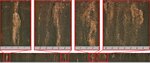
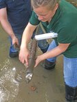
![Four close-up images of a longer sediment core (bottom). The light coloring indicates coarser sand that likely occurred from overwash flooding during a previous hurricane. This is one of a few cores collected in northwest Florida by the USGS and partners to help understand past hurricane activity in the Gulf of Mexico and northern Atlantic Ocean. The figure was compiled by Jessica Rodysill, USGS. [Sources/Usage: Public Domain.]](/uploads/original/20230428-113426-USGC 1.jpg)


Scientists are looking back thousands of years to gain a better understanding of hurricane patterns and how climate change could impact future storm activity. Knowing what has happened in the past gives insight on potential storm intensity and occurrence in the future.
The U.S. Geological Survey is working with several partners to capture real-world data and identify the frequency and strength of past storms that weren’t previously studied.
One effort led by the USGS looked back 2,000 years at hurricanes in northwest Florida. During that time period, local climate conditions – including sea surface temperatures in portions of the Gulf of Mexico and northern Atlantic Ocean – were similar to today and what is anticipated in the future.
The reasons for warming differ between the two time periods though, as past conditions were due to natural factors such as changes in the sun’s radiation, and more recent warming is primarily due to human activities.
The USGS research suggests that existing records of recent storms may underrepresent how often powerful hurricanes have made landfall in northwest Florida. The research also supports forecasts by organizations such as the National Oceanic and Atmospheric Association that the number of intense hurricanes could increase in the future in parts of the Gulf of Mexico and Atlantic Ocean as oceans warm.
This science can help improve hurricane forecasts and inform policy makers and managers as they prepare adaptation and mitigation plans to protect people, infrastructure and the environment. Studying the past provides a new baseline context and perspective of storm activity as well as new insight on how the climate and other environmental factors can influence hurricanes.
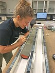
“Most existing records on hurricanes that are used to help forecast storms date back to 1851, which is just over 170 years ago, and our research is looking beyond that by several thousands of years,” said USGS research geologist Jessica Rodysill. “We are collecting sediment from below the Earth’s surface and analyzing those samples to learn about hurricane occurrence over a long period.”
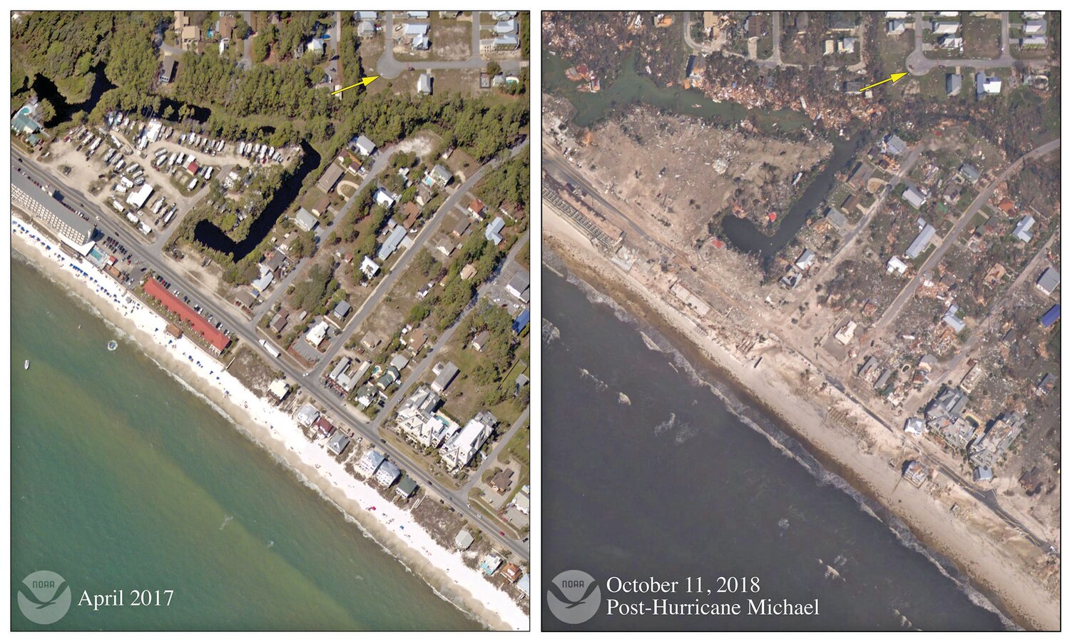
The USGS-led study in Florida identified several strong hurricanes, reaching Category 4 or 5 levels, that made landfall between the years 650 and 1250, 800 to 1,400 years ago. Prior to this research, Hurricane Michael in 2018 was the only storm stronger than Category 3 known to make landfall on the Florida panhandle. It was a Category 5 hurricane and resulted in the loss of 59 lives and $25 billion in damages across the southeastern U.S.
“With additional data, the organizations developing climate and hurricane models can build more robust projections on what types of storms could impact northwest Florida and nearby coasts,” said Rodysill. “Since this research focuses on real storms during warm periods, forecast models can be tested and validated to see if they produce scenarios that align with past events.”
The enhanced hurricane activity 800 to 1,400 years ago coincided with warmer sea surface temperatures in certain parts of the Gulf of Mexico and northern Atlantic Ocean. Temperatures in those oceans, where hurricanes typically form, are anticipated to warm over the next century to similar levels.
Existing forecasts by NOAA and other organizations predict that the frequency of powerful hurricanes could increase in those locations, and other places across the globe, due to factors such as warming ocean temperatures. The research by the USGS and partners provides additional evidence to support those hurricane forecasts for portions of the Gulf of Mexico and northern Atlantic Ocean, as scientists found strong hurricanes occurred in those areas when sea surface temperatures were warmer in the past. Future storms, however, will likely depend on a range of other factors such as atmospheric temperatures, the thickness of warm surface water and winds.
There are several conditions that support hurricane growth, and some of those can be influenced by the climate. The relationship between the climate and hurricane activity on long timescales is still not very well understood, which makes identifying hurricane trends challenging when taking climate change into account.
In addition to warmer sea surface temperatures, the past hurricane activity in northwest Florida coincided with a thicker layer of warm surface water in the Gulf of Mexico, known as the loop current. In addition, there were favorable winds that helped fuel and maintain storms, and those winds typically move toward areas with warmer air temperatures. While those and other conditions were already known to contribute to past storms within a hurricane season, studying the past allows for more detailed insight on those processes and influences.
Studying long-term records can help guide decisions on the best ways to protect the nation’s coasts, which have become more vulnerable to storm inundation in recent years following the loss of protective barriers such as dunes and marshes following flooding from rising sea levels. There is also increased risk to people, infrastructure and the economy due to growing populations and development along shorelines.
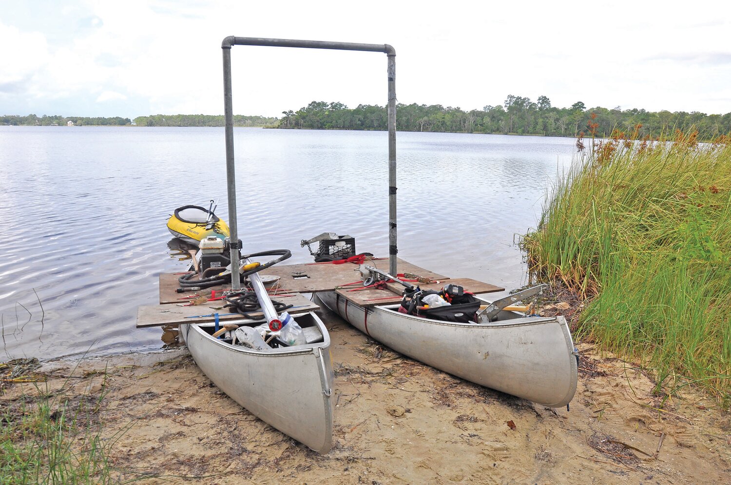
In this research, sediment samples were collected from two locations in coastal Florida; in Basin Bayou and a pond on the Bald Point peninsula. Those locations are on the coast but far enough inland that they are mostly underlain by fine sediment, allowing for sand washed over from past storms to be easily identified.
Scientists analyzed samples for characteristics such as the age, type, amount and thickness of sand deposits. Those observations gave insight on when a storm occurred in the past, its intensity, flooding extent, wave energy and other circumstances. The findings were compared to existing data by the USGS and others on the climate, including sea surface temperatures, during that time period.
USGS scientists are also involved in several projects across the country reconstructing an array of scenarios thousands to millions of years back, looking at more than just hurricanes. In addition to studying the past, the USGS provides data and insight on more recent storms and real-time monitoring of current events.
The USGS science gives a perspective on Earth before humans frequently used instruments to measure the climate and weather. This research provides knowledge of past events that until now, nobody knew happened or why they occurred.