
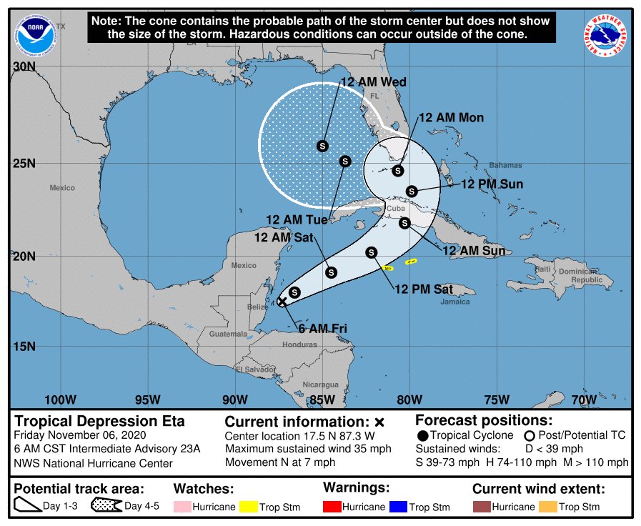
MIAMI – The National Hurricane Center has updated the projected path of Tropical Storm Eta.
Join our family of readers for as little as $5 per month and support local, unbiased journalism.
Already have an account? Log in to continue. Otherwise, follow the link below to join.
Please log in to continue |
MIAMI – The National Hurricane Center has updated the projected path of Tropical Storm Eta.
Through Monday morning, heavy rainfall from Eta will lead to catastrophic flooding across portions of Central America. Flooding is also possible across Jamaica, southeast Mexico and western Cuba.
Eta is forecast to regain tropical storm strength over the northwestern Caribbean later today (Friday, Nov. 6). Although the details of Eta are uncertain, there is an increasing risk of impacts from wind and rainfall in portions of the Cayman Islands, Cuba, southern Florida and the Florida Keys this weekend and next week.
U.S. Army Corps of Engineers Jacksonville Commander Col. Andrew Kelly will hold a media briefing at 11:30 a.m. today (Friday, Nov. 6) to discuss plans for the management of Lake Okeechobee, the St. Lucie River and the Caloosahatchee River.


